


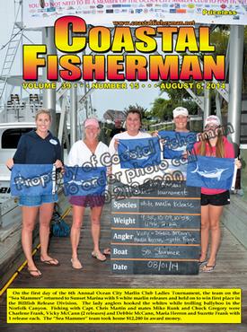
Article by Capt. Steve Katz
 We are midway through 2014 White Marlin Open week and I hope everyone is having a good time fishing, watching or even working.
When you leave the dock for a day on the water, it is important you know the weather for that day or a few days before and after your trip. While many boaters watch and monitor the weather in advance of their outing, many would also like be kept up-to-date when they are out on the water.
If all you need is basic information, then the audio marine weather broadcasts on the Marine VHF radio may be very helpful. This is a free weather service, broadcast by the United States government's local NOAA office in the area where you can receive their signal. These weather broadcasts are not always specific to boating and there are usually a few different broadcasts found on the 7 active VHF marine weather channels. Refer to your VHF instructions on how to operate the tuner to listen to the marine weather broadcasts. Other radios such as the Fusion 700 series stereo has the marine weather band receiver built-in as well as specialty weather radios.
If you are close to shore and have internet access on-board, there are many weather services available through the internet that can provide you with the current and forecasted weather. Websites and apps such as Weather Underground, The Weather Channel and NOAA provide comprehensive weather information for no-charge.
For those who want or need more detailed and comprehensive information, a few websites and apps offer detailed and specific marine weather and usually charge a subscription fee. These websites include buoyweather.com, sailflow.com and fishweather.com.
For those who travel afar, or plan to go on an extended voyage, there are weather routing services that act as a consultant to help plan your voyage based on the actual and forecasted weather. One such company is WRI (Weather Routing Inc. Their website is wriwx.com. They individually prepare forecasts that are customized specifically for each vessel's needs and location, and WRI meteorologists are available for consultation 24 hours a day, 365 days a year for subscribers.
While not exactly the same as the weather forecasts services above, there are ones that customize their weather reports for fishing, such as Roffer’s Ocean Fishing Forecasting Service (often referred to simply as Roffer's). This service is a fishing forecasting analysis that is both a graphical report and written analysis with suggested “hot spots” of where to catch the fish. They receive and use the infrared (temperature) and visible (water color, chlorophyll, and turbidity) data from all functioning U.S. (NOAA and NASA), as well as, other international (e.g. European and others as launched) earth observing satellites. In addition, they use a variety of public and private high frequency radar, ship, gliders and buoy data that have proven to provide reliable information. There are other similar services such as SSTOL.com and Hilton's realtime-navigator.com that focus on the fishing aspect of the weather.
If your boat is equipped with modern navigation electronics, you probably have the capability to add your own satellite weather receiver to your multifunction display. This hardware allows you to view up-to-date and future weather information for most areas of the US and Caribbean out to 100 miles or more offshore. This information is broadcast in real time, directly to the antenna on your boat from orbiting satellites. Both Sirius and XM offer weather services along with the compatible hardware for most major brands of chart plotters such as Furuno, Simrad, Garmin, Raymarine and Lowrance. These services allow you to see weather such as high-resolution radar, lightning, satellite imagery, buoy data, sea surface temperatures and more, right on your display(s) in real time.
There are two major sources that provide this satellite weather, XM and Sirius – who have recently merged their audio music operation but still offer two weather services. The weather data services may be combined into one offering soon.
Sirius Marine Weather comes from WSI, an industry leading, professional weather service supplier. WSI serves federal, state and local governments along with marine, aviation, agriculture, media and energy industries with expertise in analyzing, forecasting and presenting weather information. WSI combines NOAA data with information from other government, research, commercial and proprietary sources to create timely, accurate weather information using the most reliable, sophisticated analysis methods and processes in practice today.
SiriusXM weather is available on Raymarine, Furuno, Simrad, Garmin, Lowrance and other products. The cost for a weather module is about $700, depending on the manufacturer, and the monthly subscription package can cost up to about $50 a month. The hardware consists of a "black box" receiver and an external satellite antenna.
The XM satellite weather is a product of Baron Services, through its WxWorx division. Baron collects weather data from a variety of sources, including the Department of Defense, National Weather Service and various commercial providers It interprets, verifies and packages the data for instantaneous distribution over the XM satellite network.
The WxWorx company also offers their weather service to other marine hardware manufacturers, but is computer based.
XM weather is available on Garmin systems (primary older hardware) and some computer based platforms such as, Big Bay, Nobletech and others. XM marine weather subscriptions can cost up to $50 per month.
One of the best bargains for weather is Furuno. They offer a great free weather service called Navcenter Weather, for owners of the NavNet TZT GPS chartplotters. The weather data file is downloaded through an internet connection directly to the chartplotter. This free service has detailed data for water conditions such as plankton, chlorophyl and satellite altimetry along with the traditional weather forecast. Although it is not live data once you leave internet coverage, you can download the weather right before you depart the dock with the most up-to-date weather for the day. If you have a TZT system and need more information on how to use this feature, check the Furuno website for a instructional video.
As we all know, weather can change rapidly and unexpected weather can turn a good time on the water into a miserable trip, so please be sure to check the weather before you go boating and stay up-to-date during your trip.
Captain Steve Katz is the owner of Steve's Marine Service and holds NMEA MEI, AMEI, NMEA2000 certificates, ABYC Master Technician certification and factory training from many manufacturers.


